Day 5: Walnut Grove Campground at Lower Huron Metropark to Hull’s Trace Landing at Lake Erie
27.6 Miles, 2 portages, about 8 hours paddle time
After our interesting evening at Walnut Grove Campground, I awoke to quiet, still morning. As I lounged in my hammock for a bit longer, I could hear herons calling and fish jumping in the river below the bluff where I camped. It was a great way to start our final push through the final 27 miles of our journey, and after packing up camp, we were eager to be on our way and to meet friends who would be, as they described it, our “honor guard” during the final leg of our trip!
After about an hour of padding, we met up with our old camp friend, Alex, and his biologist husband, Jake at the East Bend Launch at Lower Huron Metropark. How lucky we were to have these gentlemen paddle along with us! As we made our way through the forested bends of the Huron, we reminisced about our days working and living at YMCA Storer Camps and Jake answered our many questions about river health, local species, and human impacts on waterways. We learned so much as we chatted and plodded along on slow and still waters. As we slowly ticked off mile after mile, I wondered how much faster this trip might be with higher water levels and greater water volume. This paddle in August certainly made us work for our miles, and I felt sorry for our companions who had no one but themselves to power their own kayaks!
As we made our way into Willow Metropark, dark storm clouds began to build up and we heard a rumble of thunder or two. We pulled out our phones to check the weather radar, scanned the skies, and decided to pull off for a moment and reevaluate the situation from the Big Bend Launch at Willow Metropark. We knew that we still had about 2 hours to go until our planned break for lunch in Flat Rock, but did not want to get ourselves stuck in an electrical storm on the water, especially since much of the river had high, muddy banks that would make for a tricky pull-off and would force me to get out my tarp to give us some shelter if need be. However, for the second time in our trip, the storms seemed to split around us and move to the west. Perhaps it was an odd weather pattern for us that week or perhaps it was some greater force looking out for us, but whatever it was, we were grateful for it!
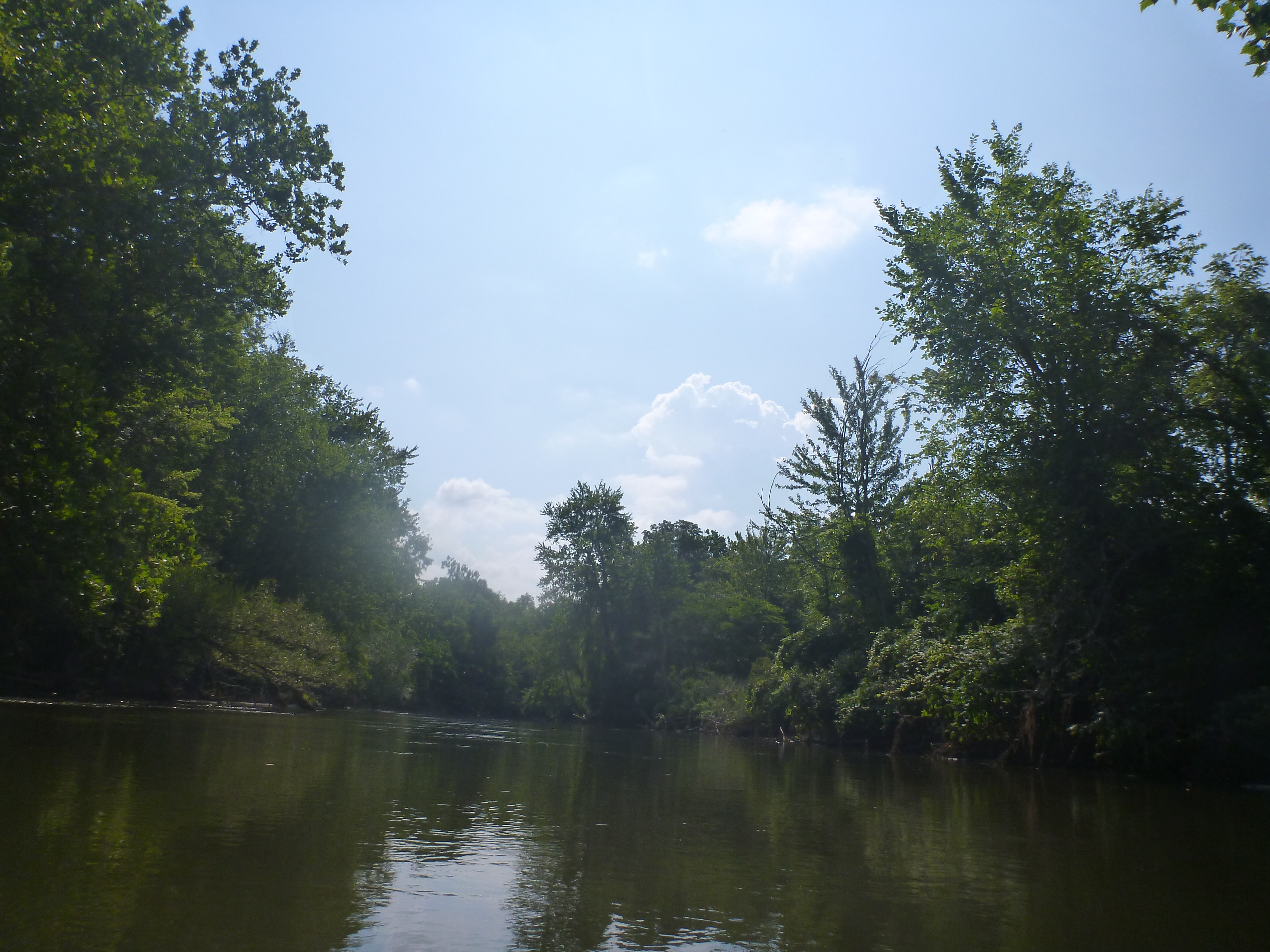
The character of the river remained consistent throughout Lower Huron, Willow, and Oakwoods Metropark. The waters were slow, wide, and murky and were surrounded by high, muddy bluffs that alternated between shady woodlands and open, manicured park lands. Along this stretch we continued to spot osprey, herons, waxwings, kingfishers, and other river birds who had become our constant companions during the trip. As the afternoon wore on, we made our way into Flat Rock, the last of the trail towns that we would visit along our journey.
The Flat Rock Dam portage is unique in the sense that one must call ahead to request that an access gate be unlocked for the portage. I had called both a week and a day prior to our portage, and when we arrived, we were pleased to see the gate closed, but unlocked and ready for our passage. The portage was a bit longer, but certainly not as long as the passages over the Ford Lake and French Landing Dams. We hauled our gear across a set of train tracks and made our way to to HuRoc Park, where we had an easy launch from the shore. We paddled a bit further before facing another portage at the Covered Bridge Dam, which was surrounded by a pretty and well-enjoyed city park. After pulling our boats out of the river, I took a quick walk down the road to snag our waiting lunch at Atwater Street Tacos, which we would later eat under the shade of a tree at the park. This was an EXCELLENT choice. My fish tacos were spicy, filling, and exactly what I needed to fuel the final leg of our adventure. While picking up our lunch, I noticed that the business is running a kayak and tube livery for the last stretch of the Huron as well. On a Friday afternoon, business was good, and had plenty of friendly company on the river during the next bit of our paddle.
After lunch, we enjoyed a short stretch of riffles just past the Covered Bridge Dam, and then were back into the slow, murky waters that we had become accustomed to on this stretch of the river. Tubers and kayakers enjoyed the river bends past Flat Rock with us until the crowds finally thinned out at their take-out point, which appeared to be the South Rockwood Boat Ramp just before the river dips beneath I-75.
With the river to ourselves and ominous clouds looming behind us, we tried hard to keep our pace, feeling sorry for poor Alex and Jake in the kayaks behind us. As we grew nearer to Lake Erie, the river widened and slowed even more, so much so that we started to notice flooded yards and docks. This was evidence of the record-high water levels of the Great Lakes this year. From houses falling off bluffs into Lake Michigan to yards and docks turned into marshy messes, the effects of the lakes’ heights can be felt even through stretches of the Huron River!
With each stroke of our paddle, we made our way through a long stretch of privately-owned land. The homes in this stretch of river were far more modest than the towering mansions we had seen on day three of our trip, and many yards were adorned with all manners of docks, a cool tree houses, boats, and evidence that the folks along this stretch of river, as opposed to those in mansions perched on high bluffs, seem to use and enjoy the river more frequently. As our arms began to ache and our hands were going numb, the number of houses increased and low yards were replaced with sea walls. As we made our way during this final stretch, many families were out back enjoying the start to their weekends on an early Friday evening.
Then, we spotted it - the bridge that crosses the river at Hull’s Trace. On the other side of this bridge would be mile 0: The point where the Huron River begins to empty out into Lake Erie. As we whooped and hollered with delight, my heart swelled to see Heather’s family and my husband were waiting and cheering for us at our takeout point. Soon, we were surrounded by family and friends once again, and the end of our journey was near.
As boats were lashed to cars, Heather, myself, and her immediate family gathered at the docks that faced Lake Erie to take part in the final ceremony tied to Heather’s sacred nibi (water) paddle. Heather prayed to the Great Spirit and expressed her thanks for the safe passage, good weather, and growth that we had both experienced through these five days together on the water. At this moment, I was overwhelmed with gratitude. I was grateful for Heather, who was so enthusiastically on board for this adventure ever since I floated the idea on Facebook. I was grateful for her positive attitude, experience, and humor that got us through both the fun and trying moments of our trip. I was grateful for my husband, who has put up with weeks of planning, shuttling us about, watching our young son, and just being an incredibly supportive partner through the entire experience. I was grateful for those who gave us advice, encouragement, and donations for our fundraiser along the way. And more than anything, I was grateful for this beautiful river, which I have come to understand so much more through our adventure.
Highlights
A great day paddling with wonderful friends
Learning about river ecology and human impacts to the river from Jake!
Street tacos in Flatwater
Our finale at Lake Erie
Concerns
The river remains heavily impacted in this stretch. The water is murky, banks are high and muddy, and there are long paddles between good stopping points
Damage to riverfront properties due to Lake Erie’s high water levels
The river gets much more industrialized the closer we got to Lake Erie
Two portages in quick succession in Flat Rock
Thoughts for the Future
The stretches through the metroparks were full of wildlife and would be fun to do again
I would love to come back and paddle around Pointe Mouillee a bit more
Day 4: Dixboro Dam to Walnut Grove Campground at Lower Huron Metropark
20.6 Miles, 4 portages, some tricky, about 10 hours paddle time
After an excellent night’s sleep back at home, it was time to make our way back to the Huron for the final two days of our trip. This proved to be the rest we needed before what was probably our longest slog of the trip. While it started with some novel and downright interesting sites and the stretch through Ypsilanti was a highlight, we were soon to meet some tougher portages, big waters, and, as always, headwinds!
We began back at the Dixboro Dam, where we had ended the previous day. The portage itself is not a long one, and the access point is located just past a public parking lot. The put in point itself involved narrow scramble down some rocks and onto a littered beach. As we continued on the final two days of our trip, we noticed more and more of this kind of scene: Heavily-littered/impacted land around the many dams we’d encounter that day.
After launching, we paddled past developed riverside that was built up and surrounded by local companies and hospitals. Soon, the river slowed, and we paddled into the backwaters of the superior dam. More industrial surroundings made way to quieter waters with impressive homes built high up on the bluffs and other homes that had flat yards running right up to the water. The early morning air was cool, the wind was low, and we were in good spirits as we made our way across these backwaters.
Soon, we came to the Superior Dam, which had a well-marked takeout point to the right side of the dam. While the portage around was a bit longer and had some steep, rocky sections, the path was clear, if not a bit overgrown by weeds. There was one section that had a low-hanging tree that we squeezed under, and with one work day (perhaps I’ll come back with some garden tools!) the path could be easily reclaimed and made more accessible. There is a lovely stone beach at the bottom of this portage, and it was evident that some locals have enjoyed a bonfire or two at this riverside spot. The put in was easy, and soon we were on our way towards Ypsilanti.
The backwaters of the Penninsular Paper Dam are an interesting site. Homes along this stretch range from grand to humble, and one riverside home, which was the only one to sit right on the water itself, caught our attention. We also spotted a relatively uncommon sight this far north - a healthy population of American Water Lotus, which impressed us with their massive blossoms and island-like leaves that were feet across. They were a real treat to observe.
The Penninsular Paper Dam was our next stop, and while it is an iconic landmark in Ypsilanti, it is also one that is about to undergo what I believe to be a great and positive change. The questions and answers provided by the Huron River Watershed Council give a great overview of the history of the dam, the hazards it poses, and the benefits of dam removal:
“The dam was originally constructed in 1867 to provide power for paper manufacturing; it failed in 1918 and was rebuilt in 1920. The Peninsular Paper Company Dam powered a paper mill in Ypsilanti that produced newsprint for Chicago for a century from the 1860’s to the 1970’s. In the mid-1980s, the Peninsular Paper Company donated the Peninsular Paper Dam and land to the City of Ypsilanti. The city created a park on the land and is now responsible for maintaining the dam.
The City of Ypsilanti is responsible for managing the dam and paying for inspections and repairs.
Under State law, the dam is not compliant with safety standards. The city is legally obligated to fix it up– or remove it. The cost to repair it is estimated at $807,000.
Once repaired, there will be ongoing inspection and maintenance costs.
The aging dam can be hazardous and is a liability for the city if an accident occurs.
It does not provide power anymore and it would cost far more to fix up the dam to generate electricity again than the revenue it could gain from the newly generated electricity.
Pen Dam is a high hazard dam that no longer generates power and costs taxpayers money to maintain and fix.
The dam does not meet state safety standards and the city is legally required to fix or remove it.
Without the dam Peninsular Park and the Huron River become more accessible for recreation and enjoyment.
The improved park and building will support businesses by creating a renewed area for residents and visitors.
Removing the dam will cost taxpayers less in the long run than repairing and maintaining it.
The dam harms the environment. The health of the river and wildlife would improve, which would also raise the quality of life for all in the area.
Making the dam generate electricity again is not an option because the dam can’t produce enough power to pay for conversion, permitting, and maintenance.
If the dam is repaired ($807,000), the costs for maintaining it will continue and increase due to the aging infrastructure. Furthermore, the city will have to do inspections every 3 years. There are no grant funds available for repairing the dam so the City will need to pay for it.
Grants for dam removal are a potential funding source for supporting removal and restoration costs. The feasibility study estimates the cost for removing the dam at $1,734,000 with additional costs for scour protection and reinforcement at two bridges (see the report for details.)
With the dam removed, the size of Peninsular Park would increase to include the land on the north side of the river that is currently submerged behind the dam. The full potential of Pen Park can be realized because the entire stretch of waterfront would no longer be divided by the dam. The former powerhouse, with its distinctive architecture and landmark neon sign, could be preserved and restored to provide a signature waterfront location for community residents to come together, celebrate Ypsilanti’s local heritage, and enjoy the river. It could also provide commercial opportunities, such as canoe, kayak and bicycle rental or other ventures.
The City of Ypsilanti owns the building so the community needs to decide the future of the building and park.
The City is required to pay for inspections and repairs of the dam so it has fewer funds to spend on community programs and infrastructure. Also, since the dam harms the river and wildlife, the quality of life in the community is compromised.
Because the dam blocks the flow of the river, people who fish have less to catch and canoe/kayakers have to remove their boats, walk around the dam, and put their boats back in. If the dam is removed, river recreation will increase and businesses near the river will have more customers.”
Needless to say, I’m excited to see how the river changes when this dam is removed! Until then, the portage involves a tight turn from the dock, a bit of a walk, and then a walk down cement stairs and loading off a cement dock. We actually had to hop off the dock to load our gear due to the low water levels. The building at this dam really is iconic, and I’m excited to be featured in the enlarged park that will be created when the dam is removed.
The paddle through Ypsilanti was gorgeous. On a summer morning, the water was full of riffles, devoid of other paddlers, and surrounded by beauty. Riverside Park is a favorite of mine, complete a long stretch of riverside land, a great playground for kids, and stunning river views. It was here that we met our dedicated ground crew (my beloved, patient, and amazing husband), who brought us the gallon jugs of fresh water we had left at home, along with some surprise gifts of fresh fruit and sour patch kids to fuel us. He’s a gem! The rest of Ypsilanti was dotted with homes and stretches of private land, but it wasn’t long before 1-94 roared ahead of us and we paddled our way into our first stretch of wide open water on Ford Lake.
As we paddled into Ford Lake, we marvelled at the abandoned and heavily-industrialized grounds of a (fittingly) former Ford plant. While it may be blasphemy to say so here in Southeast Michigan, Henry Ford became a bit like the bad guy of my Huron River story. The argument could certainly be made that he did not fully understand how his choices, made in the 1920’s and 1930’s, would impact the river down the line. However, over the course of the next two days, his impact was evident in many locations and starting at Ford Lake itself, the general quality of the river’s waters began to diminish.
Ford Lake itself is full of interesting sites. From rambling park lands to golf courses to islands, the shoreline is entirely developed for recreation or habitation. This stretch of river had much more high-density housing in the forms of apartments and condominiums. These buildings towered over the shores of Ford Lake, while docks and racks hosted paddling craft, pontoon boats, and and odd sailboat. As we paddled against a headwind, we dodge one such sailboat that was tacking to and fro in the gentle headwinds that increased as the morning wore on. After an almost 4-mile paddle over open water, we came to Ford Dam, which may have been our longest portage of the trip. The takeout point is clear and obvious, but it surprised us to learn that we had to walk a ways down the side of a busy road, cross that road, and then take a path into North Hydro Park where we could launch. Getting our gear across was not a problem, but after finally learning an overhead carry (thanks, Heather!), we had to carefully time our road crossing between packs of fast-moving cars. It was not a very fun experience, but we found the launch site afterwards to be easy to use and well-maintained.
We enjoyed a quick lunch and hydration break at North Hydro Park before paddling into our greatest challenge of endurance the entire trip: Belleville Lake
Belleville Lake is an almost 7-mile long lake that winds behind the French Landing Dam. This lake is lined from shore to shore with high-end homes, summer cottages, and even a yacht club. Paddling along this stretch reminded me of trying to canoe at my family’s cottage at Wampler’s lake on a busy Summer afternoon. Fancy ski boats and wakeboarders zipped by us, pontoon boats puttered by, and fishermen tested the waters in their small outboard boats. There was much people watching to be had during the long paddle through Belleville Lake, but the headwinds and our focus on navigating through boat traffic kept our eyes on the water most of the time.
Heather delighted in steering our canoe to safely face the boat wakes head on, and she would whoop with delight each time our boat bobbed up and down (amplified by her help). Heather’s training lies in open waters, while I’m more a technical river girl. It was evident that she was loving the challenge while I was struggling. Thank goodness for such a positive paddling partner, who constantly reminded me to keep hydrated, stay positive, and gave me the most delicious, melty snickers bar I’ve ever had during a quick paddle break on a random peninsula in the lake.
At the end of Belleville Lake, we came to the French Landing Dam. My guidebook noted that this was a long and possibly treacherous portage. I’ve even seen it recommended that others help you get around the dam, and I even had offers from folks following us on Facebook to help us get around this spot! A helpful Redditor who knew of our trip drew us a picture of what the portage looks like - I’ve included it here as I found it to be super helpful. Thank you, u/betterworldbiker! While it was a fairly long portage, it did not feel as long as the Ford Lake Dam portage. However, there was a narrow set of stairs that had to be navigated and a very small beach from which to launch. As with other dams in the area, we found the area all along the portage to be strewn with garbage, many of which came from other’s meals or fishing supplies. As we carried the boat overhead and picked our way around the narrow portage, Heather taught me to repeat the traditional chant spoken by those on a Nibi Walk. The rhythm and repetition put us on a steady pace as we carried the canoe above us to the small launch below.
Immediately after the dam, the forests around the river returned thanks to the surrounding Lower Huron Metropark. While the return of shade, forest views, and nature were a welcome sight, we also found that the character of the river had changed dramatically after Ford and Belleville lake. The water was more still and choked with weeds. It smelled different and had far more turbidity (murkiness due to sediments). The shores and bottom were no longer gravelly, but dark and mucky with sediment. She was low and slow, and we paddled hard in the evening sun to finally get to our destination of the Walnut Grove Campground at Lower Huron Metroparks.
We stayed at site 7C in the tent-only campground, which is closest to the river. However, there is no way to access this site by canoe due to the high bluff, so it was necessary to take our boat out at the designated access point, which is marked by a sign from the Huron River Water Trail. We left our boat at this launch, which was a good distance away from our actual campsite, but fortunately, none of the other campers decided to pay it any mind as it sat for a night. The campground itself was not the rustic experience that we had grown accustomed to at Island Park and Hudson Mills. We shared the campground with a fleet of RVs and campers, and the tent sites were small and packed close together, offering very limited privacy. We shared the tent campground that evening with one other family, a kind dad and his son, but I can’t imagine how tight the sites must be if all 8 were reserved.
Unfortunately, this is not a great campground for hammock camping. I picked through the heavily-littered woods that sat along the bluff above the river and finally settled on a site that was surrounded by poison ivy and hanging a tad closer to the bluff than I wanted. There is a saying in hammock camping that you “shouldn’t hang where you don’t want to fall”, and while I was confident I wouldn’t tumble into the river should my hammock fail that night, it was still a much closer call than I would have liked.
What should have been a peaceful’s night sleep by the river was unfortunately disturbed by a couple that roared into the parking lot of the tent campground, screamed at each other for a few minutes, and then sped off. This would not have been something too troubling, until we discovered that an elderly, confused dog had been left behind. The poor guy was too afraid to approach us, so I called the local police, who apparently had already been dispatched to the campground for a domestic dispute. After standing in the dark for some time keeping an eye on the wandering dog while the police worked with the couple, the dog was finally reunited with his owner and we were free to finally turn in for the night.
Needless to say, I did not have the best night of sleep, but I was excited to know that the next day would be my final stretch on the river and the following evening, I would be laying my eyes on Lake Erie itself!
Highlights
Spotting American Lotus flowers on the backwaters of the Penninsular Paper Dam
The river through Ypsilanti is beautiful
Met some really nice people along this stretch of the river who always seemed willing to help!
Pro tip: You can order pizza and canolis from Toarmina's when staying at the Walnut Grove Campground. This tasted AMAZING after a long day of padling!
Concerns
From Ford Lake all the way to Lower Huron Metropark, nearly all of the shoreline is developed
After this stretch the effect of human impacts was painfully evident
We found we no longer wanted to swim in the river by the end of this day
Thoughts for the Future
I am really excited about the stretch of river around the Penninsular Paper Dam. Once the dam is removed, the trip from Dixboro Dam (sadly, there’s no easy access at the Superior Dam) to Riverside Park in Ypsi or and access site on Ford Lake will make for a really fun day trip
Day 3: Canoe Campground at Hudson Mills Metropark to Dixoboro Dam
20 Miles, 1 portage (up to 4 when rapids are dangerous), about 8 hours paddle time
As I woke up to a gorgeous, cool morning at the Hudson Mills canoe camp, I knew that we had a fun day ahead of us. The stretch from Hudson Mills Metropark to Delhi Metropark has been my go-to day trip for years, and I was excited to return to a section of river that I know very well. My excitement was compounded by the fact that, despite having lived in the Ann Arbor area for nearly 10 years, I had never paddled through Ann Arbor proper!
As anticipated, the stretch from Hudson Mills to Delhi was gorgeous. Cedar waxwings dipped and dived before us to catch the many bugs that hovered over clear waters and gentle riffles. The river flows through a major elevation change in this stretch, which makes for faster water and even a few sets of rapids. Our first set of rapids came shortly after leaving camp at the remains of the old mill at Hudson Mills. Having never paddled this stretch of rapids before we entered cautiously, but found them to be easy to navigate in the low water levels. One important note to stress is that we passed through all of this day’s rapids during low, late Summer water levels. In the Spring, these rapids can take on an entirely different character and pose many more challenges and risks to paddler. It is important to know river conditions and one’s skill level before deciding to tackle more technical paddling through any sort of rapids.
The paddle through Hudson Mills is gorgeous and is definitely a favorite trip of mine. For new paddlers and my preschool-aged son, the roughly two-hour stretch between the Rapids View launch at Hudson Mills and Dexter-Huron Metropark is a fantastic paddle. During the Summer (in non-COVID times) one can pull off at the intersection of Mast and Huron River roads to grab a cold drink at the party store and snag a hot dog from the seasonal cart that can be found there. In the fall, it is easy to pull up riverside to the Dexter Cider Mill, where one can snag donuts and fresh cider from Michigan’s oldest, continuously operating cider mill. It’s a fantastic trip for all ages and experience levels! For a longer trip, one can press on to Delhi Metropark, which makes for a longer, almost 4-hour paddle.
It’s also worth noting that this section of rivers has several sections of riffles and very easy weirs and small rapids to navigate. As I will stress again, these more technical sections can vary drastically depending on the season and the water levels. I have been on this section when the water is high in late spring, and even seemingly simple sections can be far more treacherous when the water is fast and high. Know the river levels, know the hazards, and PLEASE, always wear a suitable life jacket. I promise, I practice what I preach - I am a former lifeguard, and I wore my PFD the entire 5 days of my trip in low, very calm waters.
This section of river also passes through a bit of private property north of Dexter. From high-end mansions to sprawling yards to older homes that have stairs that lead right down to the river, there is quite a variety of real estate along this stretch of river. Another landmark of note is a stretch of river that’s notably devoid of trees. It was in this section that a tornado tore through the river valley in 2012. As a teacher in Dexter Schools, I was actually in my school building when the tornado roared through about a half mile away. It was a huge trauma to the Dexter community, and it’s always eerie for me to see this stretch of destruction, which was littered with freshly fallen trees when I first paddled the river after the tornado.
At Delhi, we came to the Delhi rapids. In my opinion, this is the most tricky and technical point of the Huron River. When the water is high in Spring, these rapids can really rage and should not be tackled by inexperienced paddlers. However, given the low waters and August date of our trip, the rapids were quite mild in this stretch. We made it about halfway through before having to get out and walk our heavily-loaded canoe the rest of the way. While making one’s way through Delhi, it’s worth taking note of the historic bridge that crosses the river. This unique truss bridge was once knocked off of its foundation due to a tornado, but has been recently restored and is one of the most architecturally interesting bridges along the Huron River.
After enjoying our lunch at Delhi Metropark, we made our way to the most urban stretch of the river through the city of Ann Arbor. As we grew closer and closer to the city and it’s first backwaters at Barton Pond, we began to notice the mansions that reside in the Barton Hills area. This section of river hosts some of the priciest real estate in Ann Arbor, and it’s easy to understand why. Massive houses overlook Barton Pond from high bluffs, and the pond itself was surprisingly devoid of river traffic. This would change as we continued our way downriver.
The portage at Barton Dam was complicated by two factors - a complete lack of social distancing and damage to features that were meant to make the portage itself easier. As we approached the floating dock before the dam, we found it packed to the gills with unmasked teenagers, who were enjoying their time sunbathing on the river. After masking up, we picked our way around them, trying to ignore their annoyed looks at the odd canoers invading this stretch of river. As we made our way down the other side of the dam, we were excited to find another set of boat rails to help with the portage. However, the last section of those boat rails had been removed, leaving nothing but empty supports for the final stretch. I have no idea why anyone would want to take the rails off of this thoughtfully-constructed support for paddlers, but it has happened!
Not long after portaging over Barton Dam, we came to the backwaters of Argo Dam. The area around Argo is heavily-trafficked and enjoyed for two obvious reasons. First and foremost, this is the launching point for many of the river trips facilitated via the canoe liveries operated through the city of Ann Arbor. At the Argo Livery, guests can rent canoes, kayaks, or (during non-pandemic times) inner tubes. While some guests are content to simply tube the Cascades, which will be detailed in a moment, others will take their rented boat or tube all the way to the Gallup livery, which can be anywhere from a 2-4 hour trip. Again, entirely dependent on water levels and river flow!
The second interesting and crowd-inducing feature of the area around Argo is the Argo Cascades. The Cascades were created as a very interesting solution to a tricky problem, that one resource outlines as such:
“Prior to the Cascades project, Argo Canoe Livery was located on a quarter-mile stretch of stagnant water that ended at a concrete wall, a barrier which required visitors to portage down a series of steps with their canoes or kayaks to re-enter the river.
“The portage was a source of great frustration,” said Smith. “For many, it was a reason why they either couldn’t or wouldn’t take our most popular trip, a two hour paddle from Argo to Gallup Park.”
Construction on the project began in the Summer of 2011 to create a series of drops and pools that connect Argo Pond to the Huron River. The stretch includes nine drops that fall approximately 10 feet in elevation, eliminating the portage and creating a boat bypass channel. For the first time since 1830 (when the channel was built to power mills), Argo Cascades has returned the section of river to its previous free-flowing status.”
On a Wednesday afternoon, the Cascades were full of tubers, kayakers, and sunbathers. I have been told that Summer weekend can be ridiculously busy around the Cascades, and even so, I was surprised to see how busy it good on a weekday afternoon! For easy tubing trips down this section with my 4-year-old, we come early on a weekday, before the livery opens at 9 AM. This gives us several opportunities to run the rapids (which takes about 15 min/run on a tube), hike back up the path, and do it all over again before the crowds begin to arrive.
As Heather and I made our way down the Cascades, we worried about the weight and inertia of our loaded canoe as tubes drifted and swimmers dove in front of us. During very crowded times, this seems like an accident waiting to happen, and we took extra care to try back-paddle after each drop to judge our distance and timing in relation to other folks who were enjoying this fun feature of the river.
The last drop out of the Cascade and back into the main channel of the Huron is a doozy! After swamping our boat a bit, we quickly pulled over, dumped the water out of our trusty vessel, and continued on the way.
The stretch of river between Argo Dam and the backwaters of the Dixboro dam was lovely and mostly surrounded by parkland. My favorite park in particular is Island Park, situated (obviously) on an island within the Huron River. The architecture is beautiful and it is a wonderful place to picnic or get one’s feet wet in the water. On a more personal note, it was at this park where my husband took me on our third date and later proposed to me! Needless to say, it’s near and dear to my heart.
As we paddled the Ann Arbor stretch of the Huron River, we wove between many kayaks and cluster of tubes. Like the Cascades, I found it surprisingly busy for a late afternoon on a Wednesday, but during a global pandemic, floating down a river is a great way to enjoy some socially-distanced fun!
As the day grew long, we made our way into the backwaters of the Dixboro Dam, where the Gallup canoe livery, the second of two city-run liveries, can be found. The backwaters here are extensive and can be enjoyed via a day-trip from the livery located here. These backwaters are also home to several local crew teams, who share the waters with us paddlers from time to time. As we continued towards our final destination for the evening, the crowds thinned out until we had the flat water (and once again, headwinds!) to ourselves.
By dinner time, we reached the Dixboro Dam. A floating dock and ramp make for an easy exit, and it is a short walk to the other side of the dam. As there are no camping options in the Ann Arbor or Ypsilanti area, the parking lot at Dixboro Dam is where my incredible husband/ground crew picked us up. We lashed the boat to my car, made the short trip to my home just south of Ann Arbor, and enjoyed much-appreciated showers, a home-cooked meal, and a good night’s rest in a real bed. I’m glad we rested up, because the next day would prove to be one of our toughest physical challenges of the trip!
Highlights
The stretch from Hudson Mills to Delhi is gorgeous
Rapids and riffles provide some fun variety
Cider Mill in the Fall is a must-try trip!
Argo Cascades are super fun
This river is very accessible for day trips
Concerns
Crowds! Lots of groups of people, most unmasked, made social distancing doable, but trickier
Rapids can prove a real risk in high waters. Take care and portage around when they are treacherous
Damage to portage structure at Barton Dam
Thoughts for the Future
The day trip between Argo and Gallup is an easy 2-hour stretch in a boat or 4-hour stretch in a tube. This is a fun trip to take family and friends on, especially as the trip starts with the Cascades!